Digitization is saving a lot of time to the teams working on construction sites. That’s why Fernando Jesús Domínguez Barriga, project manager at Sacyr Somague & Sacyr Neopul calls it the invisible revolution.
Since Fernando arrived in February 2021 to oversee the Modernização da Linha da Beira Alta, a railway line renovation project in Portugal, he was certain that he would try to implement new processes and technologies that made its analysis and execution more efficient.
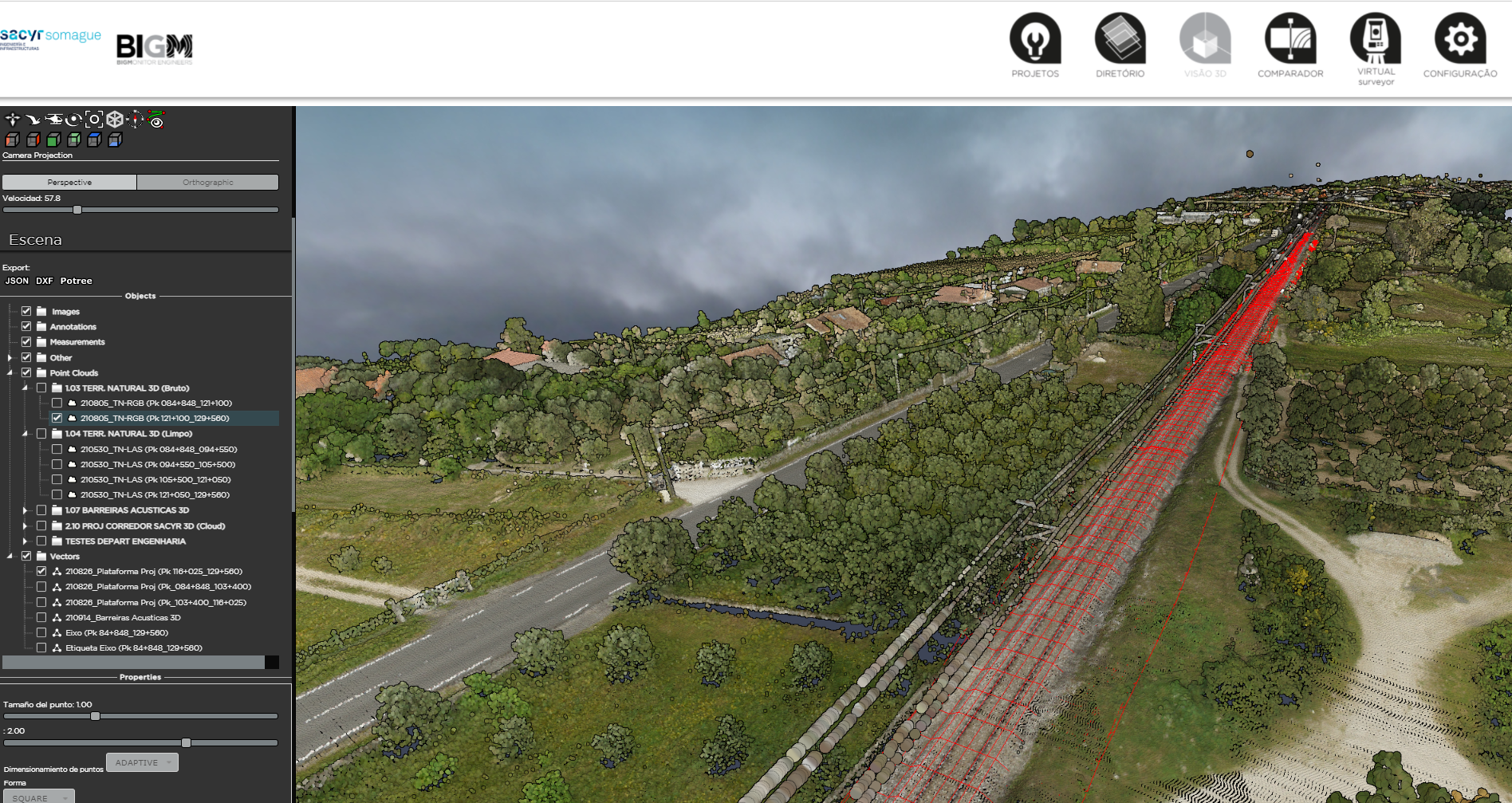
“We have integrated the most advanced LiDAR massive data capturing technology into the project’s BIM model in record time. This gives us an exhaustive, unprecedented information about the terrain, critically important for rail track renovation works”, details Fernando.

Digitizing a project is a true challenge, and a significant progress for construction works. Digital transformation is more important than ever. Data and its analysis change how we approach decision-making in projects.
“Since the railway line is currently in service, the elaboration of this model was done without accessing the railway platform. This circumstance helps us anticipate decision making several months in advance. Finally, the access to the line was granted almost 4 months after we finished the line’s digital model”, affirms the project manager at Sacyr Somague.
Digitization gives us data that is accessible to the entire construction team and the company. They are visible and analyzable on any screen, without the need to travel to the construction site, without the need for specific licenses or software, or learning how to handle a complex tool.
“We decided to give our client -Infraestruturas de Portugal- access to the viewing platform as to have a fluid communication on site, about its status and progress. We believe that sharing this technological advance with them was an important step and it has had a great reception on their end”, comments Fernando.

“We decided to use LiDAR technology to obtain information of the terrain on our site. Very succinctly, it is a scanner installed on a helicopter or other kind of aircraft, which emits a large amount of points that collect X, Y, Z information of the terrain and other elements on it (construction, vegetation). This, in combination with images taken on that flight, and after processing said data, gives us an incredibly accurate depiction of the current state of the terrain. This information helps us analyze building development with very detailed knowledge, allowing us to check for any discrepancies with the bill of quantities while at the same time detecting a great number of obstacles”, explains Fátima Calderón, Head of engineering of the Linha Beira Alta project of Sacyr Somague.
“It is important that the data everyone in the team accesses are quality data, as they are later used to make decisions. That is why we have trained part of the team in the using and processing of said data. Our intention is that the monitorization of the project can be done with data collected by drones. These data are uploaded to the viewing platform, where our initial LiDAR flight already is. This gives us quality information about the state of the project, and we can compare it with the initial state (LiDAR flight) and the theoretical finished state (3D model) at all times”, Fátima points out.

The digitization of the terrain using LiDAR technology has saved us using several topography teams for the same task. We have saved time and costs, but most of all, we have prevented the possibility of work accidents, by not using multiple teams along the rail tracks, which are still in operation.
Furthermore, the orography poses no additional obstacles when scanned, and that isn’t necessarily always the case when we are making a topographic survey through conventional techniques.
Monitoring project development using drones is becoming standardized in linear developments at Sacyr. We know that it is being used in projects such as Autopista al Mar 1 (Colombia) and the Androal line (Portugal) among others. But we believe that the combination of this kind of monitorization with the initial digitized terrain scan and the final 3D model of the project is not as extended. The combination of these three elements is what we consider construction 4.0.