
Our Tunel 4.0 project aims to improve the tunnel construction process through four courses of action: i) using Li-Fi (Light Fidelity) technology to send voice and data through tunnel lighting; ii) equipping machinery with sensors to facilitate predictive maintenance analysis and to monitor them; iii) developing real-time positioning systems for excavation; and iv) developing web applications to automate RMR (rock quality) calculations.
Retro line
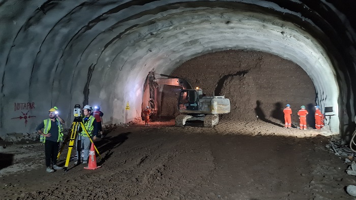
In the tunneling process, the excavation operator typically has poor visibility and must depend on the surveyor to indicate the excavation line.
“To resolve this issue, Cavosa created Tunel 4.0, a type of Google Maps for the excavation process, allowing operators to know where they are at all times, in an effort to reduce the over-excavations that can occur when boring tunnels,” explains Pablo García del Campo, Technical Director of Cavosa.
These over-excavations can result in additional excavation time, an excess of material to be removed, and an increase in the volume of concrete required for support and cladding.

RMR line
RMR is a parameter that indicates the quality of the rock mass under excavation, which serves as the basis for selecting the support, the length of the passage, and the stability of the tunnel without support. The RMR must be measured after the completion of each pass.
The work of calculating the RMR is one of the most dangerous and complicated jobs for a geologist since their presence on the tunnel’s face poses a risk and the manual measurement of the distance between fissures on the rock face is a laborious task.
For that reason, Sacyr has developed a web/mobile application that recognizes most parameters, automates the calculation, and increases the safety of personnel.

“Thanks to the development of this program, by simply taking a photograph and applying a series of filters, we can precisely define, detail, and measure each fissure on the excavation face, then calculate—for example—one of the characteristic RMR parameters, reducing the exposure time of operators and increasing their safety,” says Miguel Martín Cano, Manager of Knowledge and Innovation Projects at Sacyr Engineering and Infrastructure.
This innovation has resulted in the development of software and applications that are already in use at a number of our projects currently underway.